Décoeur Drive Traffic Calming

Share Décoeur Drive Traffic Calming on Facebook Share Décoeur Drive Traffic Calming on X (formerly Twitter) Share Décoeur Drive Traffic Calming on Linkedin Email Décoeur Drive Traffic Calming link

Overview

The City of Ottawa is conducting a traffic calming study on Décoeur Drive between Mer-Bleue Road and Tenth Line Road in response to traffic safety concerns raised by the public.

The purpose of this study is to:

  • Reduce excessive vehicle speeds
  • Improve safety for all road users
  • Support active transportation along the corridor such as walking and cycling
  • Develop context-appropriate traffic calming solutions

Study Area

The study area is focused on Décoeur Drive between Mer-Bleue Road and Tenth Line Road, as shown below:
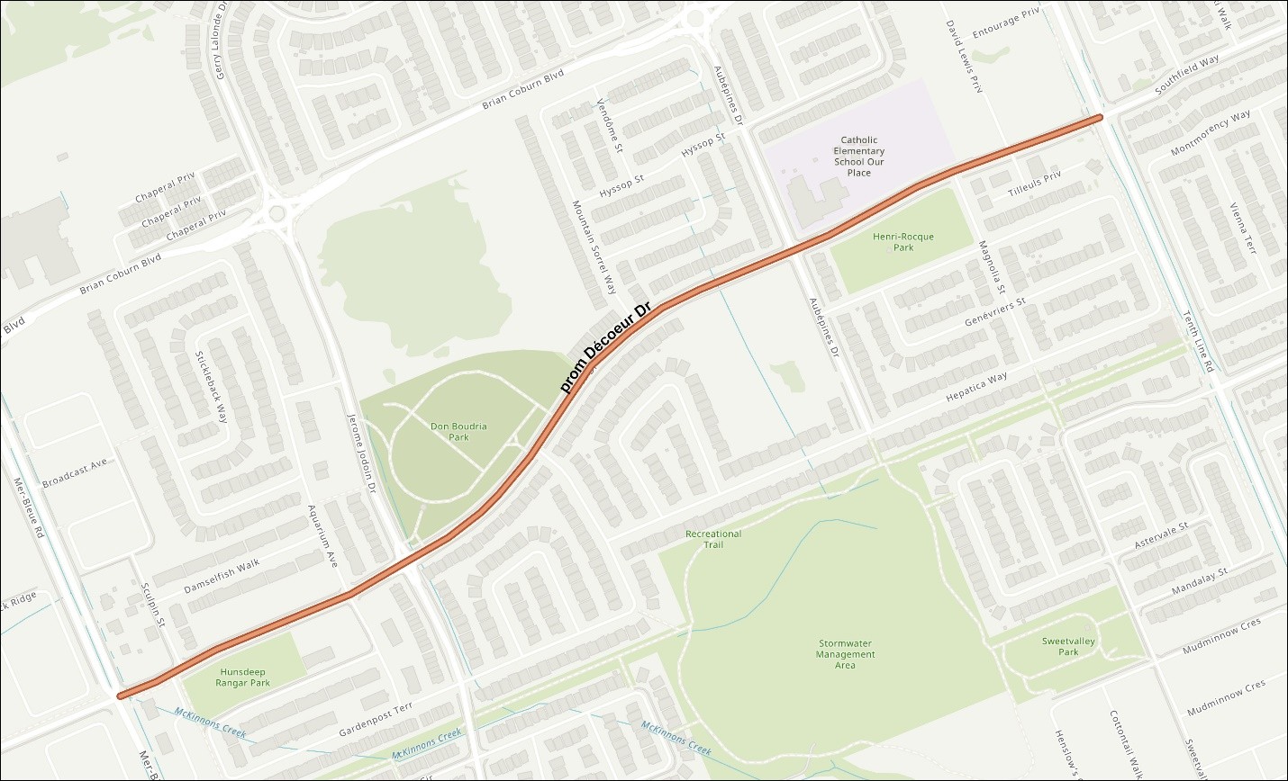
Décoeur Drive between Mer-Bleue Road and Tenth Line Road

Local Context

Décoeur Drive is a collector road that provides connectivity between the local and arterial road network in the Portobello South neighbourhood. Residents have identified concerns related to high vehicle speeds and pedestrian safety.

The Décoeur Drive corridor has sidewalks on both sides of the street with designated crosswalks at Mer-Bleue Road, Jerome Jodoin Drive, des Aubépines Drive and Tenth Line Road. There is an existing pedestrian crossover between Sculpin Street and Aquarium Avenue/Guppy Grove and a future school crossing planned at Magnolia Street being delivered through a separate project. The intersection at Mer-Bleue Road is currently being modified to a protected signalized intersection, with construction anticipated to be completed in early 2027. More information about this project can be found here.

Décoeur Drive is served by transit routes 32 and 234, providing service to and from Blair Station.

Policy Context

The City’s Transportation Master Plan identified projects that support complete street modifications to existing roads. These projects focus on reconfiguring roadways to better accommodate sustainable modes of transportation, provide access to available services and amenities, and encouraging a shift toward walking, cycling, and transit usage.

This project aligns with the City’s goals of improving safety for all road users, reducing vehicle speeds, and creating a more complete and accessible roadway.

Proposed Plans

Three proposed concept plan alternatives have been developed to help address speeding and improve safety for all road users. In no specific order, the proposed plans are outlined below:

Option 1

  • Seven sets of speed cushions
  • Bicycle lanes on both sides of Décoeur Drive between Mer-Bleue Road and Magnolia Street. On-street parking would be removed along this segment to accommodate the bicycle lanes.
  • New pedestrian crossover with road narrowing and bicycle lane bypasses at Esturgeon Street
  • Upgraded pedestrian crossover with pedestrian refuge island at Magnolia Street
  • Six corner radius reductions at minor cross-street intersections

Option 2

  • Seven sets of speed cushions
  • No dedicated bicycle lanes. Existing on-street parking would be maintained
  • Upgraded pedestrian crossover with pedestrian refuge island between Sculpin Street and Aquarium Avenue/Guppy Grove
  • New pedestrian crossover with road narrowing at Esturgeon Street
  • Upgraded pedestrian crossover with pedestrian refuge island at Magnolia Street
  • Six corner radius reductions at minor cross-street intersections

Option 3

  • Seven sets of speed cushions
  • Bicycle lanes on both sides of Décoeur Drive between Mer-Bleue Road and Jerome Jodoin Drive, and in the eastbound direction of Décoeur Drive (south side) between Jerome Jodoin Drive and Magnolia Street. On-street parking would be preserved at activity generators such as Don Boudria Park and Notre-Place School.
  • New pedestrian crossover with road narrowing and bicycle lane bypass at Esturgeon Street
  • Upgraded pedestrian crossover with refuge island at Magnolia Street
  • Six corner radius reductions at minor cross-street intersections

Please note that the proposed plan alternatives are conceptual in nature and that certain measures may be refined, modified, replaced or removed based on community feedback and during the detailed design and/or construction phases.


Overview

The City of Ottawa is conducting a traffic calming study on Décoeur Drive between Mer-Bleue Road and Tenth Line Road in response to traffic safety concerns raised by the public.

The purpose of this study is to:

  • Reduce excessive vehicle speeds
  • Improve safety for all road users
  • Support active transportation along the corridor such as walking and cycling
  • Develop context-appropriate traffic calming solutions

Study Area

The study area is focused on Décoeur Drive between Mer-Bleue Road and Tenth Line Road, as shown below:

Décoeur Drive between Mer-Bleue Road and Tenth Line Road

Local Context

Décoeur Drive is a collector road that provides connectivity between the local and arterial road network in the Portobello South neighbourhood. Residents have identified concerns related to high vehicle speeds and pedestrian safety.

The Décoeur Drive corridor has sidewalks on both sides of the street with designated crosswalks at Mer-Bleue Road, Jerome Jodoin Drive, des Aubépines Drive and Tenth Line Road. There is an existing pedestrian crossover between Sculpin Street and Aquarium Avenue/Guppy Grove and a future school crossing planned at Magnolia Street being delivered through a separate project. The intersection at Mer-Bleue Road is currently being modified to a protected signalized intersection, with construction anticipated to be completed in early 2027. More information about this project can be found here.

Décoeur Drive is served by transit routes 32 and 234, providing service to and from Blair Station.

Policy Context

The City’s Transportation Master Plan identified projects that support complete street modifications to existing roads. These projects focus on reconfiguring roadways to better accommodate sustainable modes of transportation, provide access to available services and amenities, and encouraging a shift toward walking, cycling, and transit usage.

This project aligns with the City’s goals of improving safety for all road users, reducing vehicle speeds, and creating a more complete and accessible roadway.

Proposed Plans

Three proposed concept plan alternatives have been developed to help address speeding and improve safety for all road users. In no specific order, the proposed plans are outlined below:

Option 1

  • Seven sets of speed cushions
  • Bicycle lanes on both sides of Décoeur Drive between Mer-Bleue Road and Magnolia Street. On-street parking would be removed along this segment to accommodate the bicycle lanes.
  • New pedestrian crossover with road narrowing and bicycle lane bypasses at Esturgeon Street
  • Upgraded pedestrian crossover with pedestrian refuge island at Magnolia Street
  • Six corner radius reductions at minor cross-street intersections

Option 2

  • Seven sets of speed cushions
  • No dedicated bicycle lanes. Existing on-street parking would be maintained
  • Upgraded pedestrian crossover with pedestrian refuge island between Sculpin Street and Aquarium Avenue/Guppy Grove
  • New pedestrian crossover with road narrowing at Esturgeon Street
  • Upgraded pedestrian crossover with pedestrian refuge island at Magnolia Street
  • Six corner radius reductions at minor cross-street intersections

Option 3

  • Seven sets of speed cushions
  • Bicycle lanes on both sides of Décoeur Drive between Mer-Bleue Road and Jerome Jodoin Drive, and in the eastbound direction of Décoeur Drive (south side) between Jerome Jodoin Drive and Magnolia Street. On-street parking would be preserved at activity generators such as Don Boudria Park and Notre-Place School.
  • New pedestrian crossover with road narrowing and bicycle lane bypass at Esturgeon Street
  • Upgraded pedestrian crossover with refuge island at Magnolia Street
  • Six corner radius reductions at minor cross-street intersections

Please note that the proposed plan alternatives are conceptual in nature and that certain measures may be refined, modified, replaced or removed based on community feedback and during the detailed design and/or construction phases.


  • Proposed Traffic Calming Measures

    Share Proposed Traffic Calming Measures on Facebook Share Proposed Traffic Calming Measures on X (formerly Twitter) Share Proposed Traffic Calming Measures on Linkedin Email Proposed Traffic Calming Measures link

    Additional Information about Proposed Traffic Calming Measures

    Speed Cushions

    Speed cushions are raised roadway features similar to speed humps, but with gaps that allow larger vehicles, such as buses and emergency vehicles, to straddle them while still slowing down typical passenger vehicles. Please note the difference between Speed Bumps, Speed Humps, Speed Tables and Speed Cushions. Speed cushions are effective in reducing speeds and are designed to minimize impacts on larger vehicles. Any effect on emergency response times is expected to be minor.
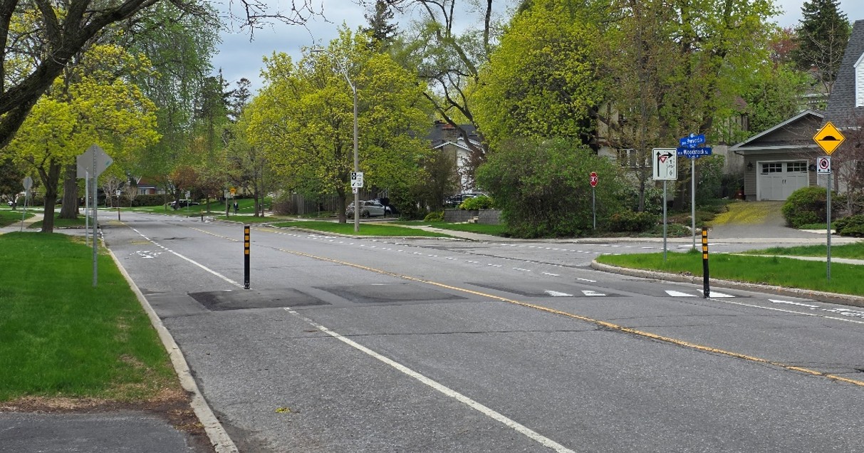
    Figure 1 – Example of speed cushions installed on a roadway with bicycle lanes

    Bicycle Lanes
    Additional Information about Proposed Traffic Calming Measures

    Speed Cushions

    Speed cushions are raised roadway features similar to speed humps, but with gaps that allow larger vehicles, such as buses and emergency vehicles, to straddle them while still slowing down typical passenger vehicles. Please note the difference between Speed Bumps, Speed Humps, Speed Tables and Speed Cushions. Speed cushions are effective in reducing speeds and are designed to minimize impacts on larger vehicles. Any effect on emergency response times is expected to be minor.

    Figure 1 – Example of speed cushions installed on a roadway with bicycle lanes

    Bicycle Lanes
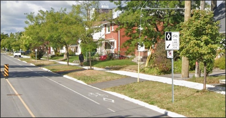
    A bicycle lane is a designated portion of the roadway marked for exclusive use by cyclists. It separates cyclists from higher-speed vehicular traffic, improving safety and comfort. In addition, the reduced roadway width resulting from the installation of bicycle lanes can help discourage speeding.

    To accommodate the implementation of bicycle lanes it is necessary to remove on-street parking, as well as prohibit stopping along the length of the bicycle lanes.Figure 2 - Example of a painted bicycle lane Corner Radius Reductions

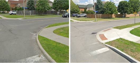
    Corner radius reductions involve modification of intersection curbs to tighten the corner with the intent of reducing speeds of right-turning vehicles as well as shortening crossing distances for pedestrians.

    Figure 3 – Example of a corner radius reduction; before (left image) and after (right image)Pedestrian Crossovers

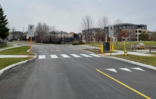
    A new Type D pedestrian crossover (PXO) is being proposed at the intersection of Décoeur Drive and Esturgeon Street, providing a connection to an existing pathway in Don Boudria Park. Pedestrian crossovers require vehicles to yield to pedestrians, allowing them to safely cross the roadway. The proposed PXO also incorporates a roadway narrowing which shortens the crossing distance for pedestrians and further helps to reduce vehicle speeds at this location.

    Figure 4 - Example of a pedestrian crossover with integrated road narrowing

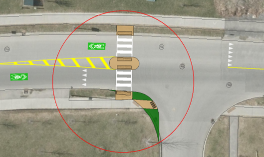
    A planned school crossing at Magnolia Street (to be implemented by others) is proposed to be upgraded to a Type D pedestrian crossing with a refuge island as part of this project. The central refuge island provides a safe stopping point for pedestrians crossing the road, reduces the effective crossing distance, and helps to decrease vehicle speeds due to the reduced travel lane widths.


    Figure 5 - Proposed PXO with refuge island at the Décoeur Drive and Magnolia Street intersection

    In the option 2 alternative, a refuge island upgrade is also proposed at the existing Type C pedestrian crossover between Sculpin Street and Aquarium Avenue/Guppy Grove.

    Pedestrian crossovers can improve pedestrian safety by providing a clearly marked and controlled crossing point, increase driver awareness of pedestrian activity, and make crossing more convenient and comfortable for all users, including seniors, children, and persons with disabilities. By creating safer and more accessible crossing opportunities, PXOs may also encourage walking and support active transportation along the corridor.


Page last updated: 28 Aug 2026, 02:13 PM